Measand End, Haweswater, Burnbanks
More Articles in the Patterdale to Haweswater subsection
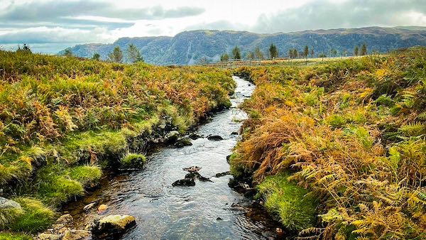
Measand Beck from the footbridge on Measand End
Measand End, Haweswater, Burnbanks, Coast to Coast
Measand End forms the lower eastern flank of Long Grain, where the fell’s steep upper contours ease and broaden as they descend toward Fordingdale Bottom. Here, broken crags give way to grassier shelves and glacially moulded slopes, creating a landscape that feels both dramatic and unexpectedly pastoral. To the south, the rock architecture curves into Lad Crags, the two faces linked by a small, sheltered plantation that softens the transition from fell to valley floor.
This quiet corner above Haweswater is notable not only for its shape but for its life. Wild horses graze the open fellside, while red deer move cautiously along the margins of woodland and scree, often betrayed first by sound rather than sight. The stillness here rewards patience.
From the open slopes of Measand End, the view unfolds widely across Haweswater and beyond, taking in Harter Fell, Branstree, Selside Pike and the long, sloping back of The Rigg. For Coast to Coast walkers approaching or leaving Burnbanks, Measand End offers a moment of spaciousness and calm—a fellside shaped by ice and water, and still governed by weather, wildlife, and time.
Measand End Long Grain
The lower slopes of Long Grain steepen briefly into broken crags before easing and spreading as they descend toward Fordingdale Bottom, forming the fellside known as Measand End. Following the arc of the cliffs northwards draws the eye into Fordingdale, where the land opens and softens. Above, Long Grain rises to 680 metres, its broad summit scattered with small pools and peat hollows, a quiet extension of Low Raise shaped by water, weather, and long retreating ice.
Measand End
Seen from Bampton Common, Measand End looks out across the head of Haweswater, a landscape that shifts constantly with light, weather, and season. The view is dominated by the great forested peninsula of The Rigg projecting into the water, with Speaking Crag forming a nearer rocky spur before it. Howe Island lies beyond, tucked at the far end of The Rigg, while the higher ground of Branstree and Harter Fell rises behind, closing the long eastern horizon.
Drybarrow Ponies
The Drybarrow ponies are as much a part of this fellside as the red deer, living freely on the open ground with the consent of their hill-farm owners, David and Gail Thompson. Measand End is one of their favoured grazing areas, where the gentler slopes and rough pasture draw them regularly, and where they are often encountered moving quietly across the fell in small, loosely held groups.
Sandhill Knotts
Sandhill Knotts is a modest knoll set just west of Measand Beck, close to where the beck spills into Haweswater. From its gently raised ground there is a pleasing outlook down the length of the reservoir toward the dam, a quieter, more contained view that contrasts with the broader fellside perspectives above.
Four Stones Hill
From the path running beside Measand Beck, a small viewpoint near one of the many cascades opens a clear line of sight toward Four Stones Hill. Framed by falling water and enclosing slopes, the view feels momentary and intimate, revealed briefly as the route follows the beck down toward Haweswater.
Measand Beck Cascade
Measand Beck drops through countless cascades and small waterfalls between the deer fence at Measand End and its meeting with Haweswater. The path stays close to the beck as it climbs toward Fordingdale Bottom, and although the ascent is steep, it is made exhilarating by the cool, lush atmosphere created by fast-flowing water, shaded rock, and constant movement.
Take the Coast to Coast Guide With You
Available on Apple Books — £12.99
Hiking the Coast to Coast combines step-by-step route directions, interactive mapping, hundreds of original photographs and information about the landscapes, history and places encountered along the route.
© 2026 Roy McKee · Coast to Coast
Contact - Privacy. - Terms


