Flat Fell, Nannycatch, Coast to Coast
More Articles in the St Bees to Ennerdale Bridge subsection
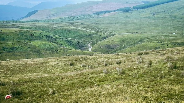
Descending Flat Fell to Nannycatch near to Flat Fell Screes
Flat Fell Screes, Nannycatch, Coast to Coast
Flat Fell (272 m) is the lesser sibling of nearby Dent Fell (352 m), and together they mark the first upland threshold of the Lake District for eastbound Coast to Coast walkers. Both are classed as Wainwright Outlying Fells and are separated by the narrow corridor of Nannycatch Road. The eastern face of Flat Fell drops steeply into the valley as a ragged series of scree slopes known as the Flat Fell Screes — a dramatic and unexpected spectacle for those new to Lakeland terrain. Though the valley floor walk beneath these screes is only half a mile, it offers a concentrated burst of natural beauty: shifting light, flinty crags, mossed walls, and the low murmur of Nannycatch Beck guiding the way.
Scree Slopes of Flat Fell
The Coast to Coast path follows the quiet course of Nannycatch Beck beneath the imposing eastern slopes of Flat Fell. Above, vast scree fields spill down the mountainside, their loose rock and shattered stone creating one of the most dramatic landscapes on this western approach to Ennerdale.
Eastern Slopes of Flat Fell
The eastern flanks of Flat Fell descend steeply into Nannycatch Valley, where vast scree slopes cloak the mountainside beneath the grassy summit. Formed by centuries of frost shattering and gravity, the loose stone gathers in chutes and fans, revealing a landscape that continues to evolve with every passing winter.
Flat Fell Screes and Dent Fell
Viewed from the Heckbarley path above Blakeley Moss, the rugged screes of Flat Fell dominate the foreground while Dent Fell rises beyond as a broad, rounded backdrop. Striking bands of conifer woodland weave across the hillsides, adding texture and colour to this dramatic meeting of rock, forest and open fell.
🪨 Geology Insight
Scree, Talus and Colluvium – What’s the Difference?
The vast slopes of broken stone beneath Flat Fell are commonly known as scree. Geologists often use the term talus for the same feature—a steep accumulation of angular rock fragments that has fallen from higher ground under the combined action of frost and gravity.
These slopes are created by freeze–thaw weathering. Rainwater enters tiny cracks in the rock and freezes during cold weather. As the water turns to ice, it expands, gradually forcing the rock apart until fragments break free. Gravity then carries these blocks downslope, where they collect as extensive scree or talus slopes.
A broader geological term is colluvium, which describes any loose material that accumulates at the foot of a slope through gravity. Scree is therefore one type of colluvium, distinguished by its coarse, angular stones. Other colluvium may consist of soil, clay, sand or mixed rock fragments carried downslope by rainwash and slow ground movement.
The extensive screes of Flat Fell are among the finest examples on this section of the Coast to Coast Walk, revealing a landscape that is still evolving under the combined influence of frost, gravity and time.
Flat Fell and Blakeley Circle
From Scarney Brow, the ancient Blakeley Raise Stone Circle rests beneath the imposing scree slopes of Flat Fell. Little has altered in the surrounding landforms since the monument was raised, allowing today’s walkers to share much the same rugged backdrop that overlooked this ceremonial site thousands of years ago.
Flat Fell Summit Cairn
Standing on the broad summit dome of Flat Fell, this simple cairn marks the highest point of the fell at 272 metres. Looking north from the southern slopes, the landscape softens into rolling pasture and low hills around Frizington, revealing a quieter aspect of this western Lakeland fell.
East Summit Cairn
From the southern edge of Flat Fell’s scree slopes, this smaller eastern cairn looks across the broad grassy dome to the true summit beyond. The gently rising skyline contrasts with the rugged mountainside below, revealing the surprisingly tranquil character of the fell’s upper reaches.
View towards Ennerdale
From the summit of Flat Fell, the view extends north across Meadley Reservoir and the wooded slopes of Swinside into the broad valley of the River Ehen. Beyond, the distant outline of Kelton Fell Top fades into drifting mist, marking the transition towards the wild landscapes of Ennerdale.
Low Cock How from Flat Fell
From the summit of Flat Fell, Low Cock How Farm sits amid lush green pastures beneath the rising fells of Ennerdale. A bright pool catches the light beside the farm, adding a touch of colour to this tranquil landscape at the threshold of one of the Lake District’s most celebrated valleys.
Meadley Reservoir and Frizington
From the summit of Flat Fell, Meadley Reservoir forms a tranquil foreground to the distant town of Frizington. Fed by Mere Beck from the slopes beneath Blakeley Raise, its still waters provide a peaceful conclusion to a landscape shaped by rugged screes, open fells and quiet valleys.
Flat Fell Plateau
Viewed from the southern edge of Greenthwaite Plantation, Flat Fell reveals the broad, level summit that gives the fell its name. Beyond, Dent Fell rises above it, its eastern slopes patterned with lighter and darker bands of conifer woodland, creating a striking contrast between open fell and managed forest.
Take the Coast to Coast Guide With You
Available on Apple Books — £12.99
Hiking the Coast to Coast combines step-by-step route directions, interactive mapping, hundreds of original photographs and information about the landscapes, history and places encountered along the route.
© 2026 Roy McKee · Coast to Coast
Contact - Privacy. - Terms


