Flat Howe Round Barrows, Sleights Moor
More Articles in the Grosmont to Robin Hood's Bay subsection
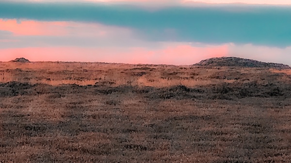
Flat Howe Round Barrow South (nearest) and Flat Howe Round Barrow North (furthest)
Flat Howe Round Barrows, Sleight Moor, Sleights
There are a number of Bronze Age burial cairns on Sleights Moor. In the area known as Black Brow, which marks its summit, there are two burial cairns which are both named Flat Howe, or Flat Howe North and Flat Howe south. These Barrows mark the north end of a chain of Barrows extending from Low Woof Howe, some 8 miles further south along the ridge. The Barrows are located close to the Low Bride Stones and the High Bride Stones and are about 2 miles east of Grosmont. Pen Howe is a half mile south, and Breckon Howe 3/4 mile south.
Flat Howe north has a partially kerbed border of stones and a trig point set to its side. From the burial mounds there are outstanding views over the surrounding countryside, in particular to the north east where the North Sea close to Whitby is clearly visible.
Flat Howe South Round Barrow
The North and South Flat Howe Round Barrows are at the northerly end of a chain of suspected territorial Barrows that stretch across the top of the moorland ridge for 8 miles or so. The line passes next through Pen Howe which is close to the A169 roadside, then to Breckon Howe (again near the road side), where it turns to the east to Flass Brow and then resumes its southern course to Robbed Howe. It then turns south east to the Foster Howes, south again to Ann's Cross on Anne's Howe, Louven Howe, Lilla Cross on Lilla Howe where it turns south west to Lilla Rigg and finally to High Woof Howe and Low Woof Howe.
Top of Flat Howe South Barrow
Flat Howe South stands at an altitude of 290m on Black Brow only 100 yards or so from its sibling barrow, Flat Howe Norfh at 289m. The top of Flat Howe South is completely covered in dense heather and there is nothing of note to see. The Barrow is about 6 feet high.
Flat Howe North Round Barrow
Although furthest from the Coast to Coast path this Barrow is the most well known. There is a trig stone on the west side of the Barrow. It is apparent from the Barrow's shape that entry has been made into it although there is no official record of such.
Flat Howe North Round Barrow
A round barrow is a common genus of tumulus and often a protected archaeological monument. Most were built between the late Neolithic to the Late Bronze Age period, i.e. 2200 bc and 1100 bc. Commonly, round barrows are circular in shape and are either Bell Barrows, Disc Barrows, saucer barrows or bowl barrows. They are a topping of earth and stone over a burial place. Many of them are surrounded by a ditch, some with kerbs or flat berms (level spaces on a sloping plane).
Flat Howe North Round Barrow
There is often a stone chamber within a Round Barrow, in the centre, which houses the corpse. Round Barrows are often made in chains or clusters, around the first one. In this case the Round Barrow is the north end point of an 8 mile ridge of Round Barrows.
Grouse Butts Pond
A large pond lies at the end of a north west bound track extending from Fair Head Lane on Sleights Moor. The pond is very close to Flat Howe North and appears to be associated with a line of grouse butts.
Coast to Coast Trail Guide
Hiking the Coast to Coast
"Hiking the Coast to Coast" is a digitally enhanced eBook available from Apple Books for all people who have either a Mac, an iPhone or an iPad, and is designed to accompany you on your walk of the Coast to Coast path. The trail guide contains Ordnance Survey maps and other advanced mapping features, step by step directions, hundreds of colour photographs, details of the route, its conditions in different weather and research snippets relating to places of interest along the way.
