River Wiske, Danby, Coast to Coast
More Articles in the Danby Wiske to Swainby subsection
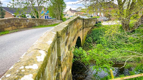
Wiske Bridge in Danby Wiske
River Wiske, Danby Wiske, Coast to Coast
The River Wiske begins at the foot of the North Yorkshire Moors near Ingleby Arncliffe, where the Stoney Lane Beck meets Carr Beck, converging, to receive river status and to be re-named as the River Wiske. Many of the villages through which the river flows are named after the river, e.g. Danby Wiske, Kirby Wiske, Appleton Wiske and Newby Wiske. The River is loosely horse-shoe shaped, originally flowing south to north then turning east at East Rounton, and finally turning south at Birkby until reaching the Swale at Kirby Wiske. Brompton is the approximate centre of the southern, open end of the horseshoe. The Wiske was previously named the Foulbroke. It is about 15 miles long.
Wiske means water meadow, and as this river runs through a large swathe of the Vale of Mowbray, through mostly flat meadows, this would explain why so many places are named after it. During wet weather the river often overflows onto the surrounding fields, leaving behind a lot of nutrient rich silt.
The Yorkshire Wildlife Trust received a government funded Water Environment Grant in 2019 to continue its restoration program of the River Wiske. The river had been adversely affected by the diversions of water sources to make the river act as a large drain to speed up the outflow of drainage. To do so meant altering the course of the river which caused flooding downstream. Wildlife and communities were affected by this. Farms have also allowed field chemicals to enter the river.
The restoration program is aimed at re-addressing these matters and restoring the river to its natural course, cleaning up the water by removing sediments and chemicals and thereby providing a natural and safe habitat for the wildlife in this area.
Wiske Valley Sydal Lodge
From the Coast to Coast path, a little beyond Sydal Lodge, there is a fine fieldscape across to the North York Moors. The view overlooks the Wiske Valley near its source not far from Ingleby Arncliffe, identified by the first line of trees stretching across the fields.
River Wiske Danby Wiske
At Danby Wiske the River rarely reaches more than a modest depth and width, and flows for most of its journey in low lying farmland. It does, however, provide very useful water drainage at times of flood and is an important wildlife corridor.
River Wiske Danby Wiske
The natural wildlife corridor provided by the River Wiske provides homes for water voles, otters, pipistrelle and long eared bats, kingfishers, reed buntings and lapwings.
River Wiske Rectory Moat
At the south side of Danby Wiske is a Rectory Moat. The Moat is fed from the Wiske waters at the north east corner of the Moat, just visible in this image. A short channel lies between the Wiske and the Moat.
River Wiske Kirby Wiske
The River Wiske converges with the River Swale just south of Kirby Wiske, a few miles west of Thirsk. Wiske derives from the latin name wisca, which means water meadow. This term aptly describes the river, almost the entirety of which flows through low-lying meadows, and which often overflows, spilling into and flooding them.
Coast to Coast Trail Guide
Hiking the Coast to Coast
"Hiking the Coast to Coast" is a digitally enhanced eBook available from Apple Books for all people who have either a Mac, an iPhone or an iPad, and is designed to accompany you on your walk of the Coast to Coast path. The trail guide contains Ordnance Survey maps and other advanced mapping features, step by step directions, hundreds of colour photographs, details of the route, its conditions in different weather and research snippets relating to places of interest along the way.
