Cringle Moor, Broughton, Coast to Coast
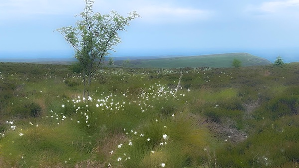
Cotton Grass on Cringle Moor
Cringle Moor, Great Broughton, Coast to Coast
Cringle Moor, also known as Cranimoor, is a small dome shaped moorland protruding from the north ridge of the Cleveland Hills between Bilsdale West Moor to the west and Cold Moor to the east. The Moor dominates the eastern horizon from Lord Stones. To its south is the broad fertile valley of Raisdale. The domed summit sits at 432m and has an ancient burial cairn upon it, known as Drake Howe. The northern ridge top of Kirby Bank drops steeply. Along this ridge extends the Cleveland Way, Coast to Coast path and Lyke Wake Walk.
Cringle Moor from Lord Stones
Cringle Moor peaks at 432m. Upon the summit is the Drake Howe Burial Cairn. The walk to the top is moderately steep but with wonderful views over Mowbray and Raisdale.
Cringle End
Where the Coast to Coast path deflects 90 degrees near the summit, there is a curved seat and a terrific viewpoint over the Vale of Mowbray. There is also a Boundary Stone and trig stone. there is a steep fall here, known as Kirby Bank, hence the reason for the path deflection.
Cringle End Beacon Stone
The Trig on Cringle Moor is stationed at 400m on the west edge of Kirby Bank, where the path is deflected to the south east. Busby Moor is seen pointing to the north with Dromonby Bank assumning its eastern face. The west side of Kirby Bank begins at Cringle End and extends eastwards. The neighbouring Boundary Stone to the trig is the Beacon Stone.
Kirby Bank Cranimoor
Cranimoor is the other name for Cringle Moor. Kirby Bank, as with Carlton Bank, has many disused jet mines that are positioned just above the lower footpath between the 310 to 320m contours. From Cringle End they have the appearance of arched adits.
Boundary Stone "F" Face
There is a long row of Boundary Stones atop Cringle Moor, many of which are marked with the initials F on one side and E on the other. The inititlals refer to Lord Feversham, Lord of the Manor of Bilsdale and James Emerson, Lord of the Manor of Kirby.
Boundary Stone "E" Face
The Boundary Stones' positioning once gave rise to a contentious boundary dispute revolving around a key Boundary Stone located on the col between Cold Moor and Cringle Moor, and the Beacon Stone on Cringle End. They now line up differently and pass through Drake Howe, the summit of Cringle Moor, reflecting the court's decision in favour of James Emerson.
Cringle End and Kirby Bank
The Coast to Coast path stretches along the moorland ridge from Cringle End, passing over the top of Kirby Bank before falling to the col that buffers Cringle Moor from Cold Moor. The col is the eastern head of the Y shaped valley of Raisdale.
Mining Works Kirby Bank
Looking down a gap created by a past landslip in Kirby Bank there is a clear aerial view of the undulations left by the multitude of jet mining adits as the Bank nears the lower footpath that encircles the Moor.
Cotton Grass Cringle Moor
During July and August, Cringle Moor is dappled with clutches of vivid white cotton grass, mingled between the heather in the lower areas of the purpling heath.
Cringle Moor from Cold Moor
Gazing west from Cold Moor the whole of the east face of Cringle Moor is seen. Particularly visible is the precipitous north east declivity of Kirby Bank, and the Cringle Moor Plantation.
Coast to Coast Trail Guide
Hiking the Coast to Coast
"Hiking the Coast to Coast" is a digitally enhanced eBook available from Apple Books for all people who have either a Mac, an iPhone or an iPad, and is designed to accompany you on your walk of the Coast to Coast path. The trail guide contains Ordnance Survey maps and other advanced mapping features, step by step directions, hundreds of colour photographs, details of the route, its conditions in different weather and research snippets relating to places of interest along the way.
